Atlantes Neerlandici New Edition
Explokart Research Project by Peter van der Krogt
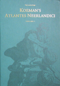 Bibliography of atlases published in the Netherlands, replacing the the Atlantes Neerlandici (1967-71 and 1985), the bibliography of terrestial, maritime and celestial atlases and pilot books, published in the Netherlands up to 1880, by Professor Cornelis Koeman (1918-2006). To honour his pioneering work in this field, the new edition got the title Koeman’s Atlantes Neerlandici.
Atlantes Neerlandici by Peter van der Krogt features:
- New bibliographical descriptions of the atlases, based upon an inquiry to about 1500 libraries all over the world, according to the latest standards.
- Illustrations and full descriptions of all the maps
- Illustrations of all the frontispieces
- Each volume includes a specific group of atlases and has its own indexes.
In 2002, Peter van der Krogt was given the Sir George Fordham Award for Cartobibliography, presented triennially by the Royal Geographical Society with Institute of British Geographers, and was based chiefly on his Koeman’s Atlantes Neerlandici. Three years later Peter received the IMCoS-Helen Wallis Award and, the same year, the 2-part volume III of Koeman’s Atlantes Neerlandici (2003) was nominated for the Fourteenth Award of ILAB-LILA Prize for Bibliography.
Introduction
The Atlantes Neerlandici by Professor C. Koeman, the bibliography of atlases published in the Netherlands up to 1880, appeared between 1967 and 1971. To quote prof. Koeman’s introduction: “The idea of preparing a bibliography of atlases published in the Netherlands before 1880 occurred to me while I was undertaking research for my thesis: Collections of Maps and Atlases in the Netherlands (Leiden: E.J. Brill, 1961). Chapter VI of the thesis, unpretentiously titled “Outline of a Bibliography of Atlases Published before 1800”, was based on an inquiry into the atlas resources of libraries in the Netherlands. In 1962, when a project to reconstruct the history of the vast cartographic reproduction done in the Netherlands was initiated, this inquiry was extended, by personal visit, to libraries outside the Netherlands. The project aimed at a far more detailed description of the works than was accomplished by the “outline” chapter of the thesis. The project was guided by the conviction that the world-dominating position once held by cartographers and publishers of the Low Countries, obligated researchers in the Netherlands today to reconstruct the history of this immense output of maps, the original records of which are lost. Such a reconstruction would enable librarians, scholars, antiquarian booksellers and collectors to assess their Dutch cartographic holdings more scientifically than has hitherto been possible. My original intention, in the optimistic planning phase, was to unravel the complex system of map production in which one publisher borrowed from another, in which firms took over atlases and published them under a different title, and in which maps were printed from old plates with only the text on the back reset, and to present all of this information in a form suitable for rapid consultation.
“Many grave difficulties were encountered in accomplishing this aim. The quantity and complex character of atlas production in the 17th and 18th centuries are such that the research results defy abridgment. A bibliography of Dutch atlases, really deserving of the name, cannot assume a ready reference-guide form. Therefore, I must ask the reader to exercise indulgence and understanding when setting out to check copies of atlases or loose-sheet maps against the data in my bibliography. This work will serve as a reliable reference source only if its user has patiently studied its contents. Materials assembled by many hands, during thousands of hours of painstaking labours, are not designed for superficial skimming.”
Prof. Koeman’s Atlantes Neerlandici has now been out of print for several years, and when it was decided to publish a new edition of the bibliography it became clear that a simple photographic reproduction of the original work would not meet present requirements. Koeman’s work reflects the dialectics of progress: as the first of its kind, it exhibits the problems typical of a pioneer. A completely new edition is thus timely.
In general Koeman’s method was followed: bibliographical descriptions of the atlases and cartobibliographical descriptions of the maps, both according to their own standards. The map descriptions follow the ISBD(CM) format. For the description of the atlas as a book mainly the Principles of Bibliographical Description by Fredson Bowers was used.
The preparation of this new edition of Atlantes Neerlandici started in 1993 and 1994 with the dispatch of a questionnaire to some 1,500 libraries world-wide, asking for their holdings of Dutch terrestrial atlases published before 1800 (sea atlases and atlases of the 19th and 20th century need a special approach). To facilitate answering for those libraries with alphabetical catalogues, a list of eleven of the most important publishers/authors was added, to wit Willem Jansz. and Joan Blaeu, Jodocus and Henricus Hondius, Joannes Janssonius, Gerard and Cornelis de Jode, Gerard Mercator, Abraham Ortelius, the Ottens family, Petrus Schenk, Isaac Tirion and Frederik de Wit.
Over 10,000 copies of Dutch atlases turned out to be present in about 750 libraries. According to Fredson Bowers, “the concern of the descriptive bibliographer is to examine every available copy of the edition of a book in order to describe in bibliographical terms the characteristics of an ideal copy of this edition, to distinguish between issues and variants of the edition, to explain and describe the printing and textual history of the edition, and finally to arrange it in a correct and logical relationship to other editions.” An ideal copy is defined as “a book which is complete in all its leaves as it ultimately left the printer’s shop in perfect condition and in the complete state that he considered to represent the final and most perfect state of the book.” The description should be constructed for an ideal copy and not for any individual copy, because an important purpose of the description is to set up a standard of reference whereby imperfections may be detected and properly analyzed when a copy of a book is checked against the bibliographical description. The enormous number of copies made it physically impossible to examine “every available copy”. This “principle” is interpreted as to examine as many copies as practically feasible. To illustrate this for the first volume: the questionnaire resulted in the availability of almost 2,000 atlases in 437 libraries, of which over 800 were examined in 128 different libraries in 15 countries.
What is an atlas?
 The definition of an atlas as “a particular collection of maps, usually bound together” (Wallis & Robinson 1987, p. 311) is much too simple to be useful for a bibliography of atlases. For this purpose only those atlases can be considered which are products of a publisher, omitting all manuscript atlases and all atlases composed by private persons (the so-called atlas factices). Since it is accepted that an atlas next to maps can include texts, it would be ideal for bibliographical purposes to have a discriminating definition when a book is to be considered as an atlas and when it is a book illustrated with maps. This definition must confirm to the general acceptance that Janssonius’s Atlas Majoris Quinta Pars, the sea atlas belonging to the Atlas Novus (no. 1:405.5 in our bibliography) is an atlas, although it has 326 pages of text and 32 double page maps (that is a rate of one map page for every five pages of text); and that Willem Jansz. [Blaeu]’s edition of Lodovico Guicciardini, Beschryvinghe van alle de Nederlanden (Amsterdam 1612), is not an atlas, although it has a rate of one map page for every 2.3 text pages (396 text pages, 97 maps, plans and views on 175 pages).
Koeman wrote about this problem in the introduction to his outline bibliography of atlases (Koeman 1963, p. 119) and in 1967 in his introduction to the Atlantes Neerlandici: “A work is not entitled to the name “atlas” by the mere fact that it contains maps. Geographical works, journals, topographical descriptions, chronicles, works with topographical drawings, and the like have been categorically omitted. Quite frequently the limits of our categories are ill-defined. In the case of sea atlases and pilot guides (which themselves belong to two different categories,) the borderline between these and the group of textbooks on navigation is equally uncertain. Since the great tradition of atlas-making, originating from Abraham Ortelius’ Theatrum Orbis Terrarum, permits text into a book of maps, I have allowed a rather large quantity of text in a book with maps before disqualifying it as an “atlas”, but itineraries, such works as Guicciardini’s description of the Netherlands, topographical descriptions (Boxhornius’ Theatrum) and the like are excluded.” But, Koeman did not give a proper definition. That is not unique: the “prefatory note” of the first large bibliography of atlases A List of Geographical Atlases in the Library of Congress (1909) by Philip Lee Phillips, does not give a definition of an atlas. And Koeman’s first follower, the Atlas français by Mireille Pastoureau, does not give a definition either (Pastoureau 1988). Ingrid Kretschmer and Johannes Dörflinger give, in the introduction to Atlantes Austriaci, merely a list of characteristics of an atlas instead of a definition (Kretschmer & Dörflinger 1995).
After publication of Atlantes Neerlandici map historians and cartobibliographers felt the need to define an atlas more properly. One of the first who discussed the definition of an atlas is David Woodward (1982); however he did not give a definition himself.
One of the first who tried to determine the discriminating factor between the different types of atlases was Peter Meurer in his Atlantes Colonienses (Meurer 1988) and later in his work on Ortelius maps (Meurer 1991). Meurer made a primary distinction between two main types: the collector’s atlas or composed atlas and the publisher’s atlas. The latter he defined as a “collection of printed maps in book form or bound similar to a book, in which number and order of the maps are established before delivery to the first owner and are identical in all copies of an edition” (Meurer 1991, p. 6). Meurer then tries to specify the latter definition to include a criterion for the amount of text, which will give a distinction between “atlas” and “book illustrated with maps”. Meurer decides that such a distinction is not definable. A definition on the basis of the numeric ratio between pages with maps and pages text is out of the question (Meurer 1988, p. 17; idem 1991, p. 6). Our example above makes this clear. It is better to define an atlas as a work in which maps are the main medium of information, where the accompanying texts repeat or complete the same information in words. The text however, he admits, can include non-mappable information, such as historical and statistical data.
Akerman (1995) distinguishes atlases from other sets of maps, in or out of books, by its usual possession of three defining traits: (1) the dominance of graphic elements (particularly maps) over textual elements; (2) the rough uniformity of map format, design, and presentation throughout the work; and (3) the standardization (generally), from copy to copy in each edition, of composition and arrangement of atlas components.
Akerman continues with the remark that this definition is best seen as an ideal rather than as a hard and fast rule. For bibliographical purposes the “dominance-trait”, however, is unusable, because it will be translated into a numeric ratio between text and graphics. This had been already considered by Meurer as out of the question.
A more practical definition agrees with Meurer’s suggestion in deciding if maps are the main medium of information or not. For this decision we have to go to the publisher’s intention as expressed in the title of the work. The word “atlas,” in the early decades of the 17th century, came to mean a bound collection of maps, with or without accompanying texts (Van der Krogt 1994a). A publisher who includes the word “atlas” in the title of his publication expresses his intention to give maps with texts. In the case of the Guicciardini publication by Blaeu, mentioned above, the title (in translation) is: “Description of all the Netherlands otherwise called Lower Germany, by Lodovico Guicciardini, nobleman from Florence, corrected and enlarged with more than half by the same author, with all maps of the said countries, and many view of towns after nature”. This title made it clear that the text takes first place and the maps are added to illustrate the text.
In this respect Meurer’s objection that the text may include non-mappable information is irrelevant.
An atlas is defined as a book with maps, which meets the following characteristics (freely after Meurer, Akerman, and Kretschmer & Dörflinger):
- a collection of printed maps in book form or bound similar to a book with a printed title page; in cases where text is included, the publisher’s intention to give the dominance of graphic elements (particularly maps, plans or town views) over textual elements, must be clear, either from the title (expressed by the word “atlas” or not) or from the concept of the work;
- the rough uniformity of map format, design, and presentation throughout the work; and
- the standardization (generally), from copy to copy in each edition, of composition and arrangement of atlas components.
Despite these valuable and scientific correct definitions, for the compilation of this bibliography of atlases there was a very practical reason to include works as atlases. It is a new edition of the work professor Koeman published in 1967-1985 and therefore it should include all works described in this first edition.
What are The Netherlands?
Another difficulty arises from the interpretation of the term ‘Atlases published in the Netherlands‘. Belgium, which comprised the Southern Netherlands in the 16th and 17th centuries, the Spanish and Austrian Netherlands in the 17th and 18th centuries, and part of the kingdom of the Netherlands between 1815-1830, is included (at least for the period up to c. 1800). But what of foreign work closely related to atlases published at Amsterdam, such as The Mariner’s Mirrour by Lucas Jansz. Waghenaer, which was published in London in 1588? What of Mercator’s Atlas, published at Duisburg between 1585 and 1595? Because this bibliography lays strong emphasis upon the history of an atlas, I have included all foreign publications made with copperplates used in an earlier or in a later time for works published in the Netherlands. For example, the copperplates of Mercator’s Atlas or the Civitates orbis terrarum, by Braun and Hogenberg, printed in Duisburg and Cologne resp., were later used for atlases published in Amsterdam. On the other hand, the English Atlas published at Oxford is made with the copperplates of the Janssonius-firm in Amsterdam. However, atlases made outside the Netherlands with re-engraved copperplates were not included. In cases were confusion may arise, references are made.
References
- Akerman, James R. (1991). On the shoulders of a Titan: viewing the world of the past in atlas structure. -Thesis, submitted in partial fulfillment of the requirements for the degree of doctor in philosophy, Pennsylvania State University 1991.
- — (1995). From books with maps to books as maps: the editor in the creation of the atlas idea. – In: Editing early and historical atlases / edited by Joan Winearls. – Toronto [etc.]: University of Toronto Press, 1995. p. 3-48.
- Koeman, C. (1961): Collections of Maps and Atlases in the Netherlands: Their History and Present State. Leiden: E.J. Brill.
- Kretschmer, Ingrid, and Johannes Dörflinger. (1995). Atlantes Austriaci: Kommentierte Katalog der österreichische Atlanten von 1561 bis 1994. Wien: Böhlau Verlag.
- Van der Krogt, Peter (1994a): Van Atlas tot atlas. – In: Kartografisch Tijdschrift 20(1994)3, pp. 11-18. (summarized version without annotations: From Atlas to atlas. – In Mercator’s World 1(1996)1, pp. 61-63 & 93.
- — (1994b). Commercial Cartography in the Netherlands with Particular Reference to Atlas Production (16th-18th Centuries). In La Cartografia dels Països Baixos: Cicle de conferències sobre Història de la Cartografia 4rt curs… Organitzat per l’Institut Cartogràfic de Catalunya i el Departament de Geografia de la Universitat Autònoma de Barcelona, 70-140. Barcelona: Generalitat de Catalunya, Departament de Política Territorial i Obres Públiques, Institut Cartogràfic de Catalunya, 1994.
- — (1996a). Amsterdam Atlas-Production in the 1630s: A Nightmare for the Bibliographer. Imago Mundi 48 (1996): 149-160.
- — (1996b). From ‘Atlas’ to atlas. Mercator’s World 1, no. 1: 61-63, 93. (summarized translation of Van der Krogt, 1994a).
- Meurer, Peter (1988): Atlantes Colonienses : die Kölner Schule der Atlaskartographie 1570-1610. – Bad Neustadt a.d. Saale : Verlag Dietrich Pfaehler, 1988.
- — (1991). Fontes Cartographici Orteliani: das Theatrum Orbis Terrarum von Abraham Ortelius und seine Kartenquellen / Peter H. Meurer. – Weinheim : VCH Acta humaniora, 1991.
- Pastoureau, Mireille (1984). Les atlas français XVIe-XVIIe siècles : répertoire bibliographique et étude / Mireille Pastoureau [et al.]. – Paris : Bibliothèque Nationale, 1984.
- Varanka, Dalia (1994). Editorial and design principles in the rise of English world atlases 1606-1729. – A Dissertation submitted in partial fulfillment of the requirements for the degree of Doctor in Philosophy in Geography at the University of Wisconsin-Milwaukee, June 1994.
- Wallis, Helen M. & Arthur H Robinson (1987). Cartographical innovations: an international handbook of mapping terms to 1900. – Tring : Map Collector Publications (1982) Ltd., 1987.
- Woodward, David (1982). The technique of atlas making. – In: The Map Collector 18(March 1982), p. 2-11.
Volumes

Published
-
Volume I:
The Folio Atlases published by Gerard Mercator, Jodocus Hondius, Henricus Hondius, Johannes Janssonius and their successorsPublished 1997.
With c. 1000 illustrations. 755 pp.
ISBN 978 90 6194 268 9. -
Vollume II:
The Folio Atlases Published by Willem Jansz. Blaeu and Joan BlaeuPublished 2000.
With c. 700 illustrations. 636 pp. ISBN 978 90 6194 438 6. -
Volume III:
Ortelius’s Theatrum Orbis Terrarum, De Jode’s Speculum Orbis Terrarum, The Epitome, Caert-Thresoor and Atlas Minor, The Atlases of the XVII Provinces, and some other atlases published in the Low Countries up to c. 1650Published 2003.
With c. 600 illustrations. 970 pp. in two volumes. ISBN 978 90 6194 448 5. -
Volume IV:
The Town Atlases: Braun & Hogenberg, Janssonius, Blaeu, De Wit, Mortier and othersPublished December 2010.
With c. 3,900 illustrations. 1,716 pp. in three volumes. ISBN 978 90 6194 458 4. -
Volume IVA:
The Galerie Agréable by Pieter van der Aain co-operation with Hans Braat.
Published 2012.
With c. 2,600 illustrations. 954 pp. in two volumes. ISBN 978 90 6194 080 7.Forthcoming volumes
-
Volume V:
The Folio Atlases by Visscher, De Wit, Danckerts, Allard, Schenk, Valk, Mortier, Covens, Ottens and others, c. 1660-c. 1825Production in progress.
Expected Summer 2024. -
Volume VI:
Hand Atlases, Pocket Atlases and Thematic Atlases, c. 1680-c.1820Manuscript prepared in co-operation with Hans Braat (†2009), Jan-Willem van Waning (†2021) and Ewoud Baarsma (†2015).
Editing in progress by Marissa Griffioen and Jornt Leeflang.
Planned for 2025. -
Volume VII:
Pilot Guides and Sea Atlases
In preparation by the working group “Sea atlases”: Jason Hubbard (†), Hans Kloosterboer, Nils Persson, Erik Walsmit and Rikkert Wijk, supervised by Peter van der Krogt.
Planned for 2025/2026. -
Volume VIII:
Atlases of the 19th and 20th centuryIn preparation by the working group “19th and 20th century atlases”: Marijn Rang, Sebastiaan Ruinard, Bert Schipper, Reinder Storm, Maarten Witkam (†) and Joop Zomer, supervised by Martijn Storms in co-operation with Peter van der Krogt.
Available from:
Brill Publishers, Leiden